Radar Topography Map of Montserrat Courtesy of Dr. Ian C.F.Stewart. Learn more about the Radar Topology Maps.
Month: November 2015
Montserrat Geothermal Data
Geothermal Data for Montserrat Mr. Thomas Yeung, head of Montserrat Utilities (see www.mul.ms), the state-owned utility responsible for electricity, water and sewage services on Montserrat, commissioned a report on Geothermal Energy Potential for the island. At present electricity is generated using expensive imported diesel fuel. He has released the report by Professor Paul Younger of… Continue reading Montserrat Geothermal Data
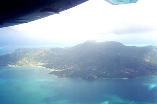
Montserrat Gallery
Montserrat Geology
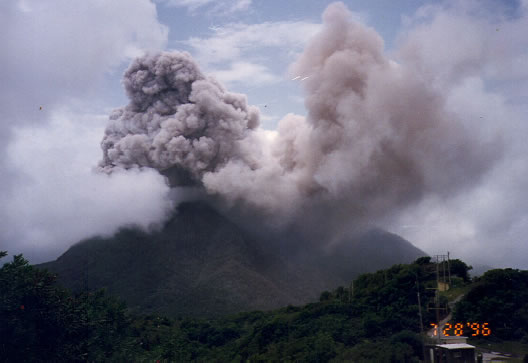
THE GEOLOGY OF MONTSERRAT Montserrat island (with an area of 102 sq.km and a pre-1995 eruption population of 10,500, is composed of three major volcanic centers, ranging in age from Pleistocene to Recent The northern end of the island is formed by the Silver Hill complex described by Rea (1970, 1974) as composed of two-pyroxene… Continue reading Montserrat Geology
Providencia Bibliography
Providencia Bibliography Arden, D.D., 1969, Geologic history of the Nicaraguan Rise: Transactions Gulf Coast Association Geological Societies, v. XIX, p. 295-309. Geobel, V.W., 1985, On the Miocene vulcanism of Providencia Island , Colombia , western Caribbean (abs): Geological Society of America Abstracts with Programs, v.17, p.159. Hollcombe, T.L., Ladd, J.W., Westbrook, G., Edgar, M.T., and… Continue reading Providencia Bibliography
Providencia Map
Geological Map of Providencia, West Indies
Providencia Radar Map
Radar Topography Map of Providencia Courtesy of Dr. Ian C.F.Stewart. Learn more about the Radar Topology Maps.
Providencia Geothermal Data
Geothermal Data for Providencia The Providencia stratovolcano is extinct with no known hot springs or young volcanic deposits. The youngest volcanic deposits are the lithified and faulted ignimbrites that occur as valley-fill deposits in a deeply incised topography eroded into the felsic carapace of the island. An unsatisfactory K/Ar age (a biotite sample contaminated with… Continue reading Providencia Geothermal Data
Providencia Gallery
Providencia Gallery
Providencia Geology
The Geology of Providencia The Colombian island cluster of Providencia (latitude 13 degrees 21 minutes N., longitude 80 degrees 22 minutes E.), the adjacent Santa Catalina island and four small islands inside a broad lagoon with a massive fringing coral reef, are all part of a deeply dissected Miocene stratovolcano. The islands have a combined… Continue reading Providencia Geology