
Montserrat Map
Montserrat Geological Map Geological map showing the four main volcanic centers. Reproduced from Volcanic Hazard Atlas of the Lesser Antilles […]
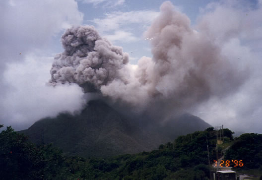
Montserrat volcano
Montserrat Geological Map Geological map showing the four main volcanic centers. Reproduced from Volcanic Hazard Atlas of the Lesser Antilles […]
Montserrat Bibliography (For the 1995 to present eruption see end of list) Ambeh, W.B., Lynch, L.L., Chen, J. and Robertson,
Radar Topography Map of Montserrat Courtesy of Dr. Ian C.F.Stewart. Learn more about the Radar Topology Maps.
Geothermal Data for Montserrat Mr. Thomas Yeung, head of Montserrat Utilities (see www.mul.ms), the state-owned utility responsible for electricity, water
THE GEOLOGY OF MONTSERRAT Montserrat island (with an area of 102 sq.km and a pre-1995 eruption population of 10,500, is